Heritage Highlights: Market Place Column (1683), Castle Hill (1897) (neolithic)
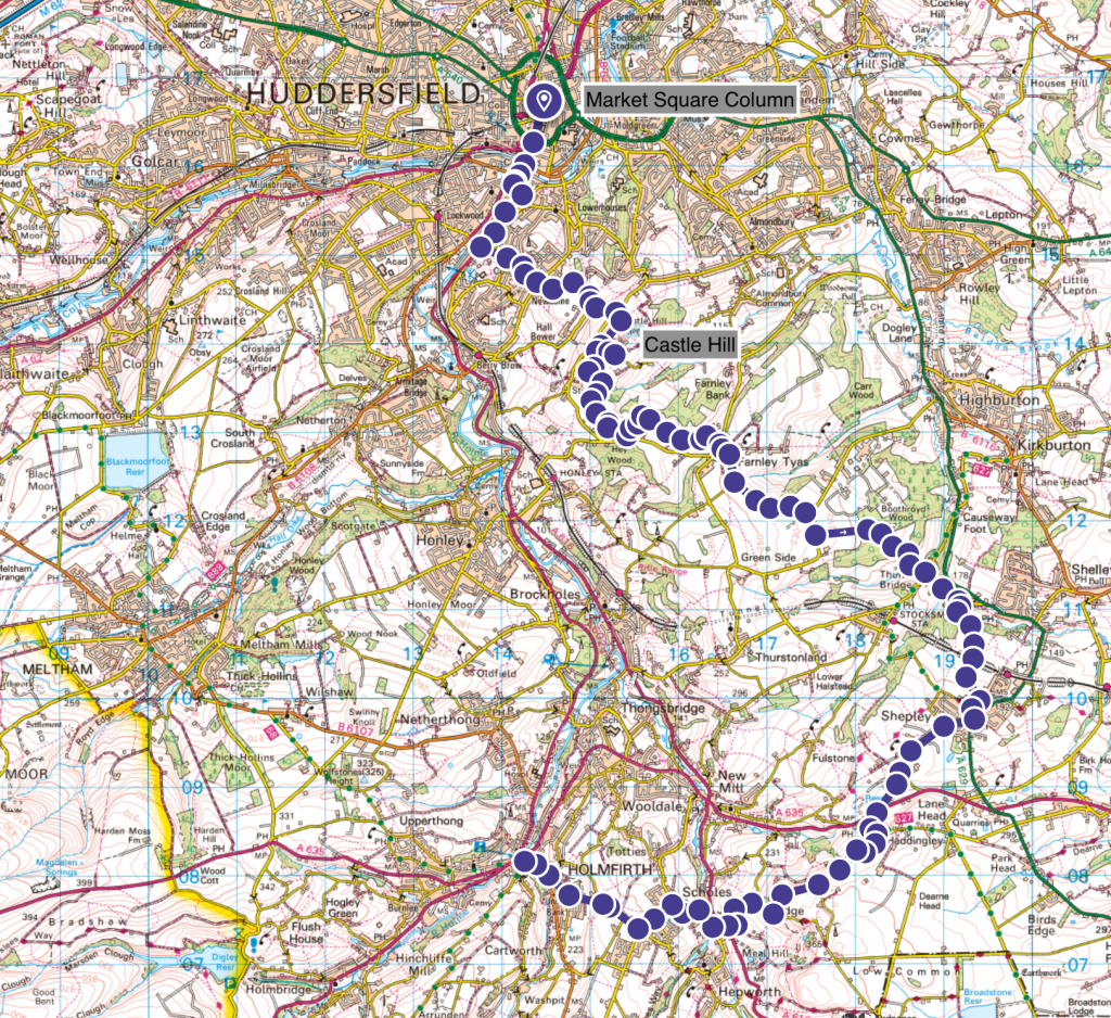
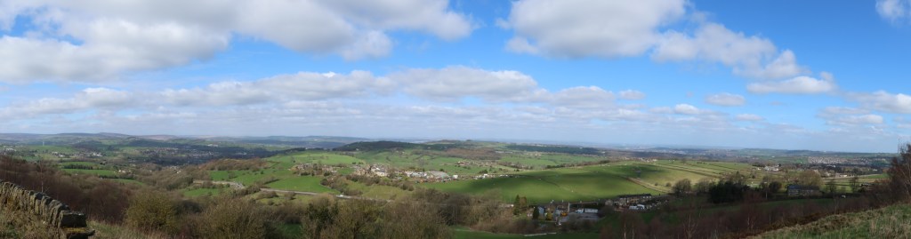
Choose a sunny day for this one. Although I have indicated six hours, you will probably want to take your time and enjoy a full 8 to 9 hours of walking and admiring the scenery on this part. The views are excellent, particularly from Castle Hill and the approach to Jackson Bridge. The descent into Holmfirth is arguably world class in its aesthetic appeal. The navigation to Farnley Tyas is tricky, and can be really horrendously muddy in wet conditions so this is actually best done after a prolonged dry spell. Luckily this is only for a very short section and the rest of the trail is on a broad mix of every sort of path.
Start this section at the crossroads of Westgate, Kirkgate, John William Street and New Street in the centre of Huddersfield. You are surrounded by heritage architecture, and there have been tracks and pathways where the roads are now for hundreds of years. With your back to John William Street, begin by walking ahead on to New Street, and carry on until you reach the ring road. At the time of writing (April 2023) there is a lot of building work going on in the centre of town and several large scale renovation projects have begun.
Visible remains from where you are standing begin with the Market Place column, erected in 1683. It can be safely assumed that this was the initial focal point for Huddersfield, or ‘Oderesfeld’ since many centuries ago. Everything else around you is C19th or later due to the wool trade being a prominent part of the successful economy of the town from this time.
At the ring road, you need to aim straight ahead, with the massive building of Kirklees College on your right. This will take you to Lockwood Road, the A616. Pass a Colin Appleyard garage on your left, then take a small road on the left called Albert Street. Immediately, there’s another road also on your left called Queens Mill Road. Take this until it curves at the end and you will see a public footpath sign on your right. Take this, staying low level, walking alongside some mill buildings and the river until you reach the road ahead, Lockwood Scar.
Turn left, and start the long uphill climb. This is the first of three major uphill parts of this section. Stay on the main part of Lockwood Scar, turning neither left nor right, and go until you reach a cross roads at a set of traffic lights. Keep going, uphill, winding past a pub on your left and through some housing as the road winds around and stays going uphill. At the top of the road, you will arrive at a T junction which is almost on a hillside itself, making it a tricky exit in a car. On foot, just be careful to cross over the T junction onto the other side where you will see a public footpath sign. This heads up some stone steps, finally to the start of Castle Hill.
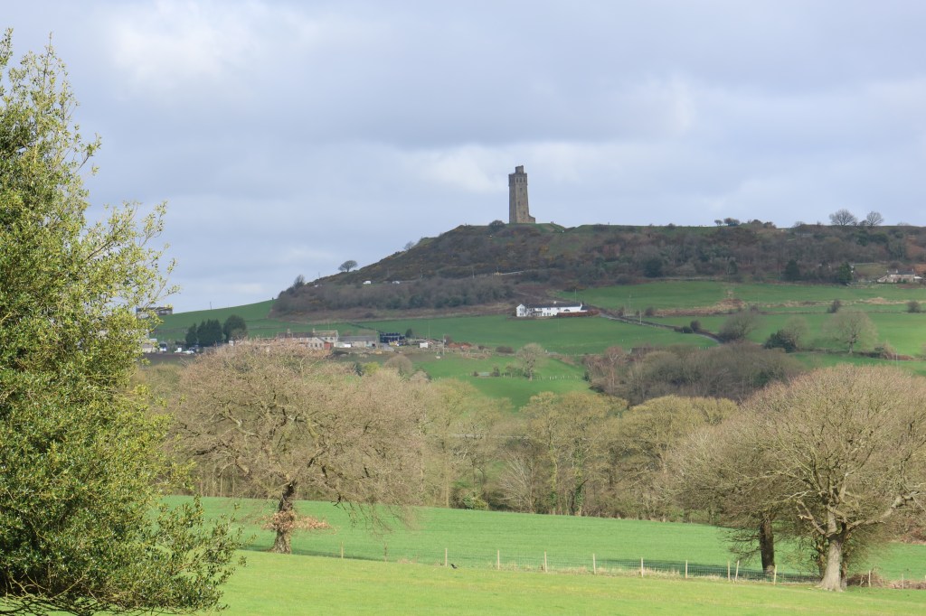
This hilltop has seen human activity since prehistoric times. Evidence has been found dating to the Neolithic, and Bronze Age. The outlines of an Iron Age hill fort can also be seen as you walk around the perimeter of the hill. An actual castle was built on this site in the C12, however quickly fell into ruin and was largely derelict by the C17th. Victoria Tower, seen today, designed by Isaac Jones of London, was completed in 1897 to celebrate the Diamond Jubilee of Queen Victoria. There is a well nearby the tower dating from the time of the medieval castle.
Head right, towards the unmissable Victorian monument. When you arrive, you will no doubt want to spend some time taking in the view, and if you are lucky you can even head inside and hike to the top viewing platform. I can recommend this, particularly at Christmas time! At the other end of the monument, the southern side, you will find a series of steps leading down to a minor road, Castle Hill Side. Turn left on this, following it downhill for a short distance until you see a public footpath sign on your right, just before a house. Take this footpath, usually muddy, and follow this to a stile.
After this, navigation can get a little bit complicated. You should have a dry stone wall on your left, so keep the same line as this wall and head to the next opening in the next wall ahead. Then, another hundred meters and a third gate or stile by a third wall. After the third one, you will enter quite a large field and the path will go towards a tumble down wall and a fence with some orange cord or rope wound by it. This is the permissive footpath (marked as a public right of way on the ordnance survey maps but the farmer ensures me it is permissive), so turn to your left with the wall/fence on your left. Do not have the wall on your right hand side as this is trespassing.
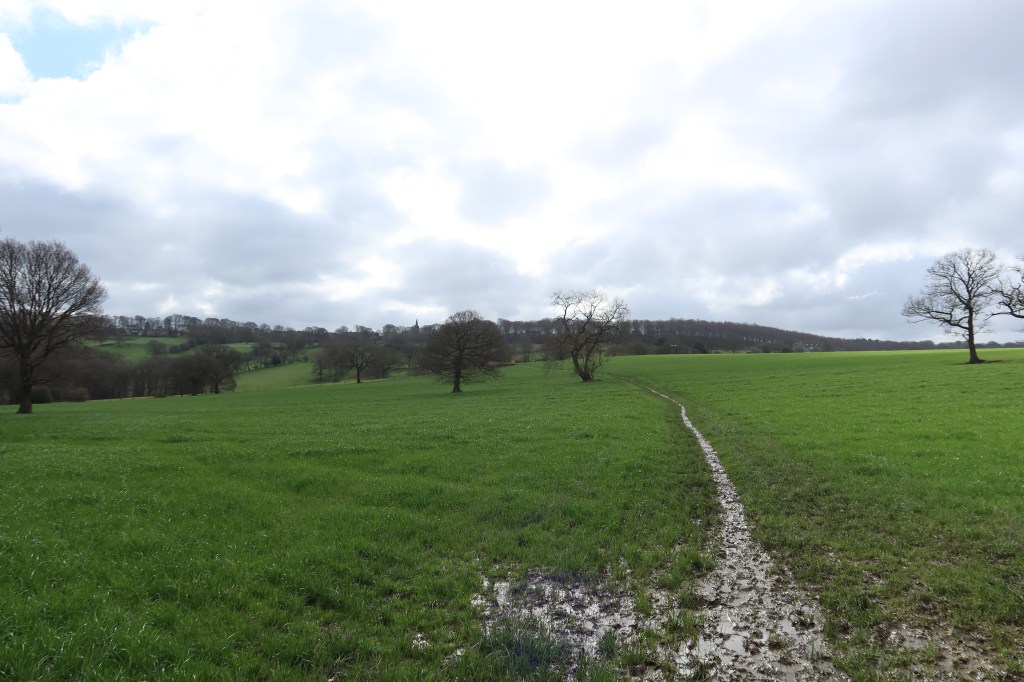
Follow this to a gate at the bottom left hand corner of the field, and then immediately head right, towards a small copse of trees and a beck. This can be really muddy so take care. Continue to follow the wall on the other side of the beck, until you reach a track going through the middle of the field, heading both left and right. Take the left option, stay on track leading you to the farmhouse of Farnley Hey (no livestock ever seen here).
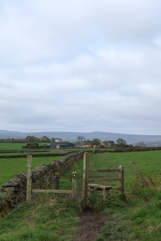
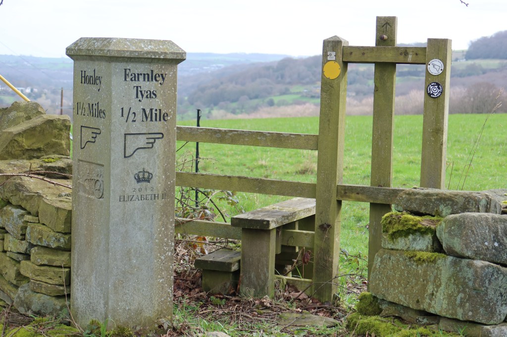
You will soon find yourself on a small road, with some lovely houses on your left hand side. Follow the road, and veer to the right to a small stile and gate with a narrow path. On the other side, go diagonally across the field to your right, through a small opening in the hedge, and then downhill, to a junction of paths and the sign below:
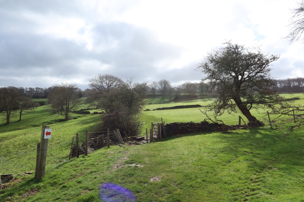
Resist the temptation to cross over this stile, and instead head right, on the muddy track, staying on this course until you reach a field with some sheep in it. Continue through this field and then keep going as the hill gets steeper, passing some benches. The view back across to Castle Hill is excellent from here, and on a blustery day with changing light the images can look dramatic. Follow the track, uphill to the right and arrive at Farnley Tyas.
Head right to the main road, called ‘The Village’, and then left, where it becomes Farnley Road. Follow this road, with a good pavement, passing Storthes Hall Lane on your left and instead taking Wood Lane, second left, down to the wonderfully named Thunder Bridge. Go across the bridge, then immediately right onto Dam Hill, keeping the river on your right-hand side. This road climbs gently until you see some signs for the TransPennineTrail, Millhouse Green in blue. Follow the sign, down a minor road, past some lovely houses near the river. A little further, slightly uphill, there is another sign at the start of a public right of way. Take this track.

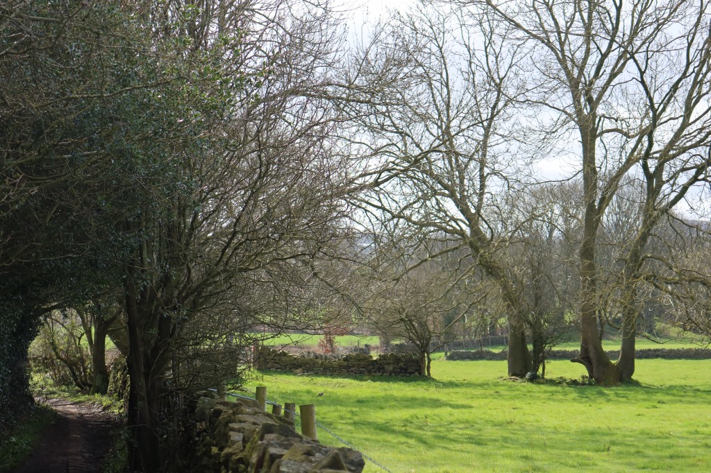
This is an excellent part of the route, where you can just enjoy the scenery without having to concentrate on navigation too much. It crosses over a railway line and there are one or two turn off paths which may turn out to be good circular trails with some exploration.
You will arrive, eventually, onto a small housing area and minor road called Field Head. Ignore Field Head Court Road, and take the road straight ahead. This will bring you to a cross roads with Station Road. Turn right, and stay on this as it winds up and to the left, coming to another T junction with the Black Bull restaurant in front of you. Take a right turn here, now Marsh Lane, and keep on this for around 1 km until it meets the main road, the A635.
Cross straight over the A635 and take up the remainder of Marsh Lane on the other side. This ends at another T junction, where you should turn left, uphill, and then soon after, take up the public right of way on your right-hand side. A short section of uphill track brings you to the top of your second major uphill section of the day. Turn right, and follow this lovely quiet track until another junction appears. Ignore the public right of way sign pointing downhill, and continue until the track becomes a road. You should arrive at a bench with the following view:

Turn right, heading downhill, on Scar hole Lane, then Tenter Hill, which in turn becomes Stayley Royd Lane. Turn right shortly after, on South View, to arrive at the A616. Cross over, taking up East Street towards the White Horse inn, with the Red Lion pub dominating the landscape on your right.

Keep following the road uphill, into a place called ‘Paris’. I can understand if you might feel a bit shortchanged by the name, but if you can imagine the letter ‘h’ added on the name after the letter ‘s’ then it all makes more sense. For anybody curious to know, there is a place called Paris Gates in Halifax, where centuries ago it was pronounced ‘Parish Gates’.
At the Boot and Shoe Inn, turn left and stay on Paris Road until you see Sandy Gate on your right. Take this minor road and it will fork in two. Take the left fork, heading downhill. You are now starting the descent into Holmfirth, and it is probably the finest descent into any town in West Yorkshire (Ilkley from Ilkley Moor is a strong contender for the top position). On a good day, the views are amazing, and the town has a lot of Yorkshire character. Cinder hills Road takes you to South Lane, which takes you to the town centre. This is the end of this section.
