This section manages to combine the best of both worlds – superb historical remains in an unbeatable setting. You will have the chance on this route to compare medieval with modern, religious with literary, lowland with highland.
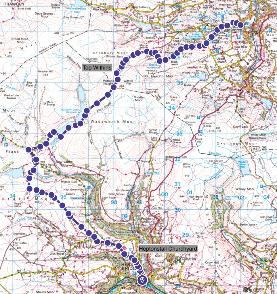
Heritage Highlights: Heptonstall Churchyard (C12th), Top Withins (C18th)
Starting from the Co-Op supermarket on Market Street, turn right and keep going until you come to a Hebden Beck. Before crossing over the bridge, turn left onto Old Gate. Continue on this for a short distance until you see a steep cobbled path on your left. There is a sign that looks like a street name called ‘Footpath to Heptonstall’. This is officially called ‘The Buttress’. In dry conditions it is excellent, however in descent after heavy rain can be a serious hazard.

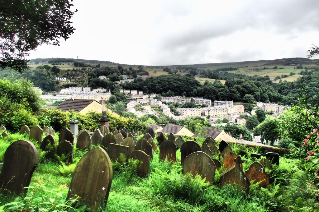
Despite its steepness, this is an excellent route towards higher ground, and you will pass a Commonwealth Graveyard on your right before meeting the first road. At the top, turn right, then immediate left, and look out for a Public Footpath signpost on your left. Take this, through some woodland, and up some stone steps set a worrying angles. At the road, turn right, uphill, towards Heptonstall. Continue up the road, turning to cobbles, and you will see a sign on your left for a heritage trail around the churchyard.
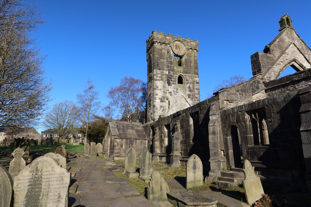
This is one of very few sites in the UK to contain two churches in the same place. The one in the picture has fallen into serious ruin and disrepair, and another one, on the left out of frame, is still used.
Hike out of Heptonstall on the main cobbled road towards the tiny hamlet of Slack. You will approach a forked road, with a church sitting in the fork. With the church on your right, continue on the left-hand road and look out of a small car park and some public footpaths on your right. Take a path heading up towards a dry stone wall, diagonally up and to the right of the road. Keep the wall on your left, and this will lead you into a piece of walled-in moorland with a good path taking you through to the other end. Follow the path, keep straight, eventually joining with the Pennine Way yet again!
A high point is Clough Head Hill, after which you will follow the path as it gently curves to the left, meeting another wall shortly afterwards. You should be able to see Gorple Lower Reservoir at this point.

Follow the Pennine Way downhill towards a gate a cross roads of paths. You should continue straight down, past a farm on your left (well walled off) towards Graining Water on King Common Rough. Cross the water onto the other side of the river and follow the trail. This section can be very busy on a sunny day.You will emerge onto a road, turn left, and continue until you see a turn off to your right, slightly uphill.
This is the Calder Are Link and Pennine Way together. It is a fantastic path, taking you to Walshaw Dean Reservoir systems, and up onto the start of what many now call simply the ‘Bronte Moors’.
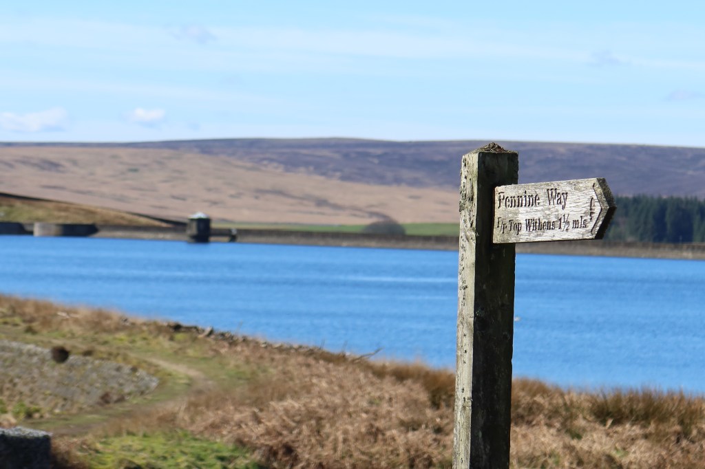
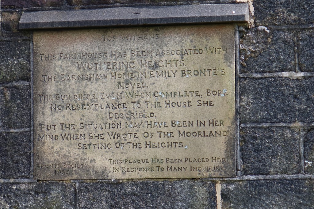
Keep following the Pennine Way for now; it will take you up the hillside and over the other side. Shortly after this, you will come across the ruins of an old farmstead called Top Withins. It has been claimed that this is the site that inspired the book ‘Wuthering Heights’ however there is a plaque on the wall of the ruin stating that there is no evidence for this and very little resemblance to this place in the book. Nevertheless, it attracts thousands of visitors a year, and I think justifiably so. It is a superb place for an afternoon walk with family and friends. My earliest countryside walks were here; first camping trips were here and first long day hikes included this place so for me it is especially worthwhile to include it in the West Yorkshire Heritage Trail. If you are searching for a high quality, safe place to encourage young people to get outdoors then you should come here.
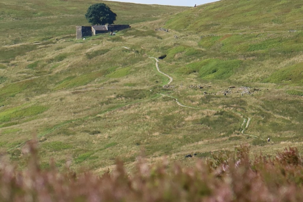
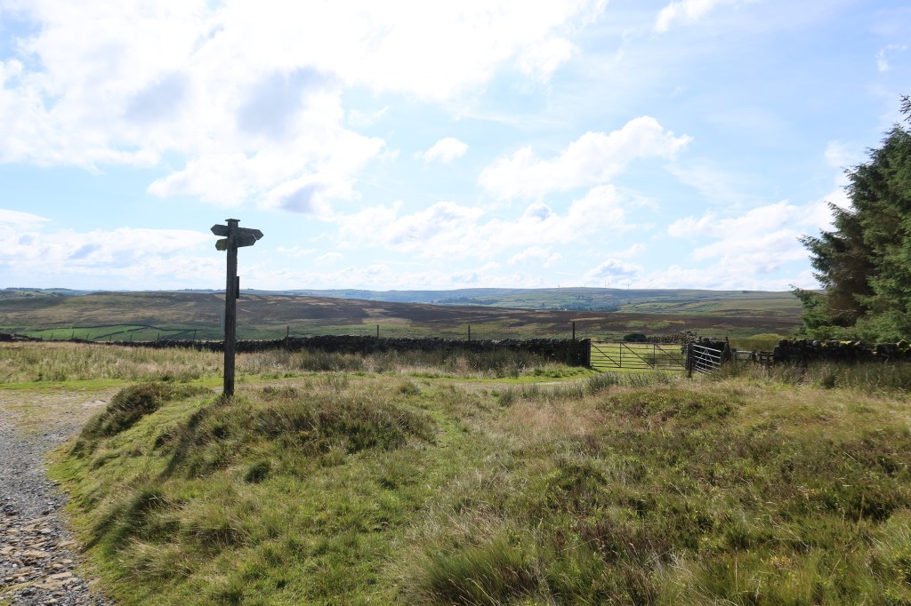
From the ruins, continue down the pathway, ignoring the right-hand turn down to Bronte Falls for now. Follow the Pennine Way just a little bit longer until you come to the signpost and junction in the photo below. A tell-tale sign you are getting near is the copse of trees which you need to be right next to before you turn right.
After turning right, follow the path with the trees on your right and you will start to head downhill. Go through the field and then right again and almost immediately left and downhill again, on a well worn track to the river at the bottom. This is Bronte Falls.

Continue over the bridge, and take up the path on the right-hand side of the stream in the picture above.
This will go uphill and even out with a view that overlooks the top of Haworth. The path is excellent all the way to the road. Cross straight over (this can be very busy) and along a small road that has plenty of parking spots and lay-bys. At the end of this road, turn right, and follow the main road to the top of the Main Street of Haworth, and the end of this section.
