
If you squint hard enough (not when walking!) you could almost be in the Italian Alps…
Except this is the Lake District – for those who like it direct, dead easy and done in less than a day. The only major challenge with this route is its test of stamina. Ready for an intensive workout? Welcome to the Helvellyn Gill route. Scroll down or read below for the video guide.
Simply park (or arrive by bus) at Swirls Car Park, at the eastern side of Thirlmere, and follow the signs to Helvellyn. The well-made path will take you across two bridges that span the lowest reaches of the Gill, and then, testing your fitness, will take you pretty much directly up the side of the mountain.
You do get some respite with a zig-zag of paths, but the angle remains quite steep. The path is excellent and well-made with large stones making up a navigation-free trail for you to enjoy either the scenery or maybe whatever mantra you have started to repeat to yourself just to keep moving. Even I had to stop for a breather at one point. The views quickly become amazing though, as seen below.
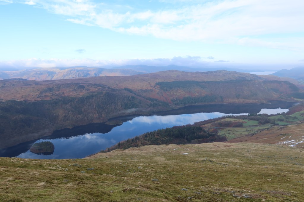
The most obvious feature you will be walking upwards towards is the western most aspect of Brown Cove Crags. This is a popular rock climbing and winter mountaineering venue, a good place to visit if you wish to practice your skills. The path skirts the crags on the right-hand side, and follows a rocky trail almost to the summit of Low Man. It gives the feel of an adventurous scramble, with loads of exposure to the west, and no technical ability to test. On a good day you can fully appreciate the central fells and the potential of much more walking to be done.
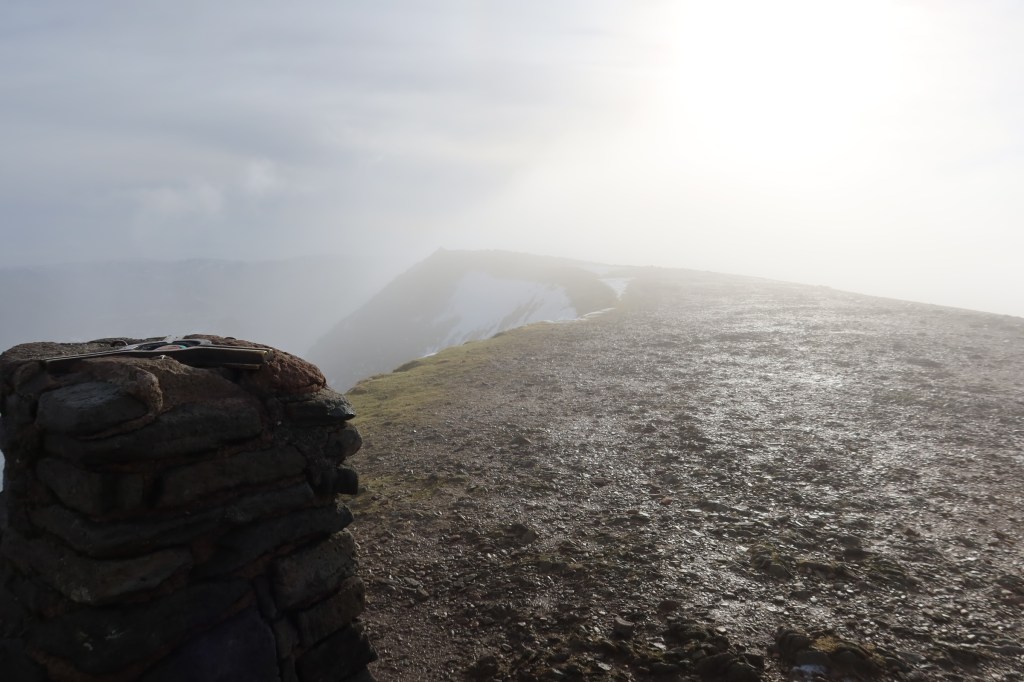
The initial summit plateau near Low Man is a highway, literally, which can be seen and followed even in limited visibility. Watch my video which was filmed in those conditions to see what I mean. One slight rise extra brings you into the 900 meter contour line and from here a very gentle hike, to the trig point on the summit of Helvellyn itself. I managed this in about 90 minutes, but I didn’t stop much.Give yourself around 2 hours to properly enjoy the view and savour the surrounding landscape. It’s worth every second.
As always in the mountains, be careful on the descent. In limited visibility, it can be really easy to choose the wrong path back and end up descending the north ridge of Low Man, or even heading south instead of north if you are not used to taking compass bearings. These things can, and do happen. I was approached on my hikes the day I filmed this by two groups of people, within minutes of each other. They were all very well equipped in terms of clothing, but had neglected to take maps with them. Despite it being a well-trodden and popular peak, it can be surprisingly complicated to get down. Take a map and compass with you, with knowledge of how to use them. I always take two different scales of map out with me – OS 1:25k and a Harvey Mountain Map at 1:40k. Between them I have loads of info and coverage of the area I’m in. I’ll do a blog post soon on my approach to navigation and a link to my intro course. It’s fun once you figure it all out 😉

Leave a comment