This lowland circuit starts in Mytholmroyd, Calderdale, and covers 22km through some of the finest parts of the Calder Valley. The YouTube video below highlights paths near Cragg Vale, former home of the infamous ‘Coiners’, Hebden Bridge, Heptonstall, Pecket Well, and finally Midgley before returning to the beginning.

The Calder Valley is glacially formed, with generous layers of dark gritstone that help to give it a distinctive feel of moody gloom in poor weather. I certainly had that on Sunday, with the weather forecast below:
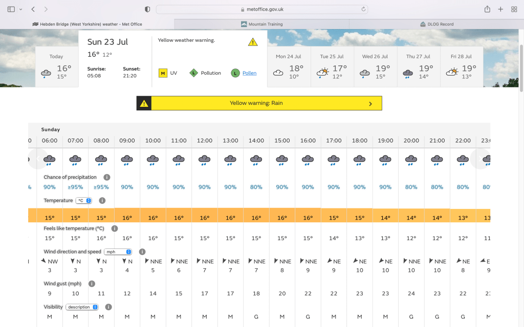
There wasn’t much rain at 2pm but the rest was accurate!
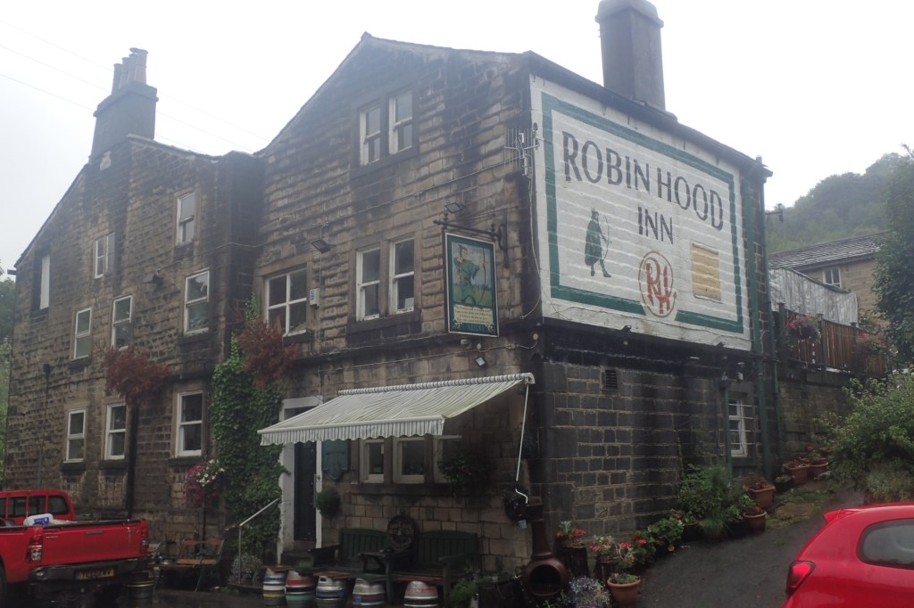
The first part of the walk takes in one of Christopher Goddard’s routes from his map of the Cragg Vale Coiners Walk. It is an excellent piece of art and guidebook to the area and well worth a look. I followed that route until the Robin Hood Inn, before striking further south and picking up the Calderdale Way, bound for the edge of the moor.
Navigation through woodland can be very tricky, especially in very wet and muddy conditions. My best advice is to use a compass if needed to work out which path is going in the best direction, and try think in terms of ‘macro’ navigation. Overall, which direction is best and does the path take you there? Finding a useful but small track in the woods might not even be marked on a map. The video shows me orientating (not orienting, that’s a spelling error!) the map using a compass, a key skill if you want to increase your adventure levels.
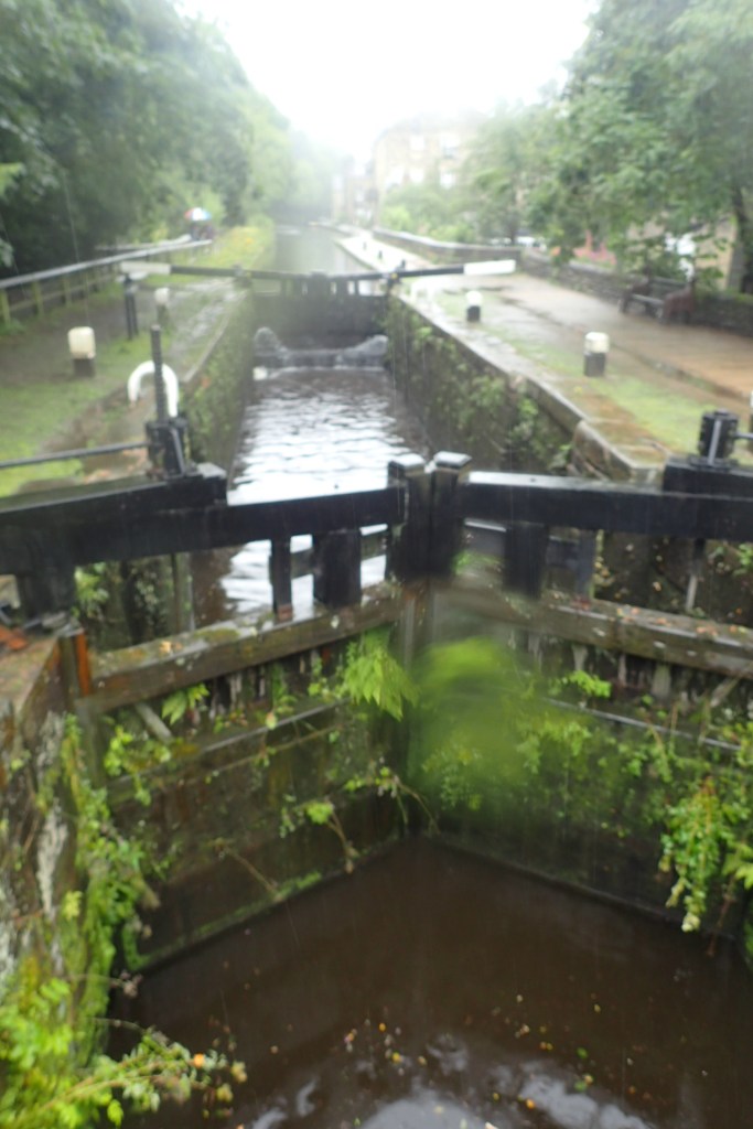
Heading down to the Hinchcliffe Arms, go past a church with an epic stone cross in the graveyard, and follow the road around to the left. This is the Calderdale Way, which you should stay on until you reach the reservoir at the top.
The next bit should be changed really, as I only discovered afterwards how much of a potential hazard it could have been. Take a sharp right by the reservoir car park, and head up the track. Take the first left by a signpost (see the film) and follow it up the hillside to a stile. Turn right to the t-junction on a well made track, then left, and keep on this until a gate at the end spills you out onto the moorland. At which point I noticed the sign on the other side of the gate:

Brilliant. Luckily, I saw none. My worst nightmare, to be avoided at all costs! There is a potential better route than this which I would have picked up had a fully recced everything beforehand. Lesson learned for next time.
For aspiring Lowland Leaders – should you be walking on the moor on access land? Is it within remit? I argue that yes it is. Each path I chose was as close to the walls as possible, and choosing a higher route to avoid the hazards of a farmyard, as long as the paths are clear on the ground and the map, is no problem in my view. I also double checked and was always within 3km of a road. At no point was I off path or ‘remote’. There is no altitude cut off stipulated by MT for this award scheme, very likely because of this reason. If in any doubt, keep as close to civilisation as possible on clearly marked paths.
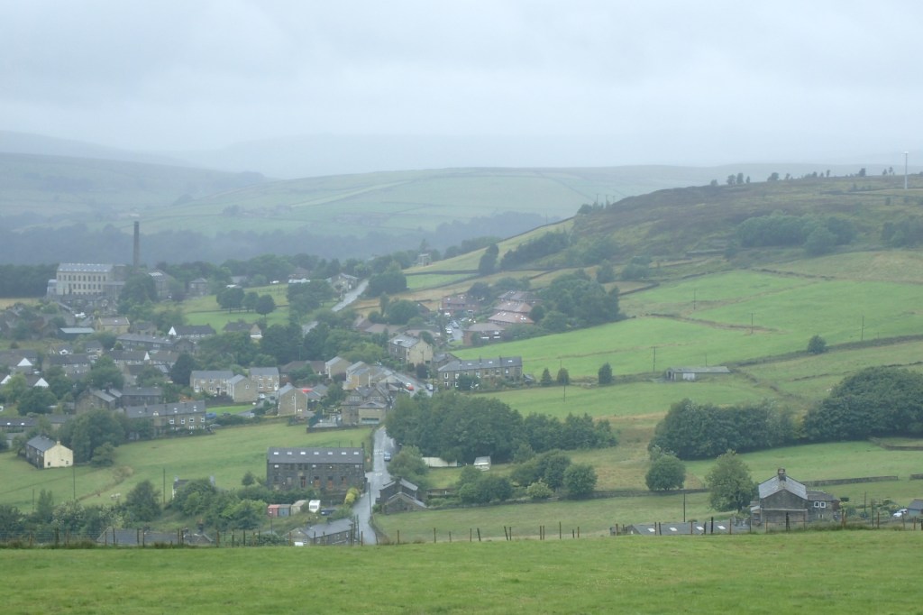
Stay close to the wall, heading north, and handrail this until you start to descend steeply. You will notice a stile on your left, take this to a well made track bounded by fences. Go through a couple of gates, still fenced in, until a good track appears on your right. Take this down, through a tunnel, to Hebden Bridge. Various paths can be taken, they all ultimately lead down to the town.
The name ‘Hebden Bridge’ is recorded as early as 1508. It translates from Anglo Saxon ‘heope denu’ meaning ‘valley of rosehips’. In the Domesday Book of 1086 it was recorded as ‘Hebedene’ but the word Bridge took another 500 years to add. It rose to wealth and prominence thanks largely to the Industrial Revolution, with the building of canals, locks, mills and workers housing to produce wool and transport millions of tonnes of coal.

The next section takes up my very own West Yorkshire Heritage Trail! Couldn’t resist including a short section. Head to the Main Street, cross over and take the cobbled lane sharply uphill to your left. This leads up to Heptonstall.
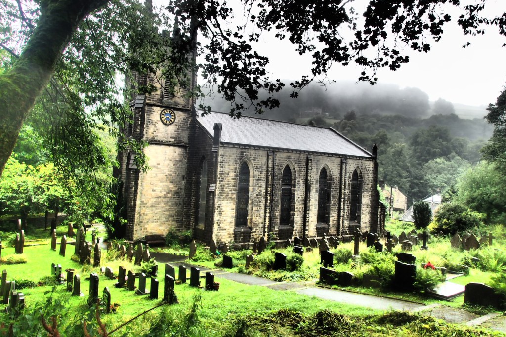
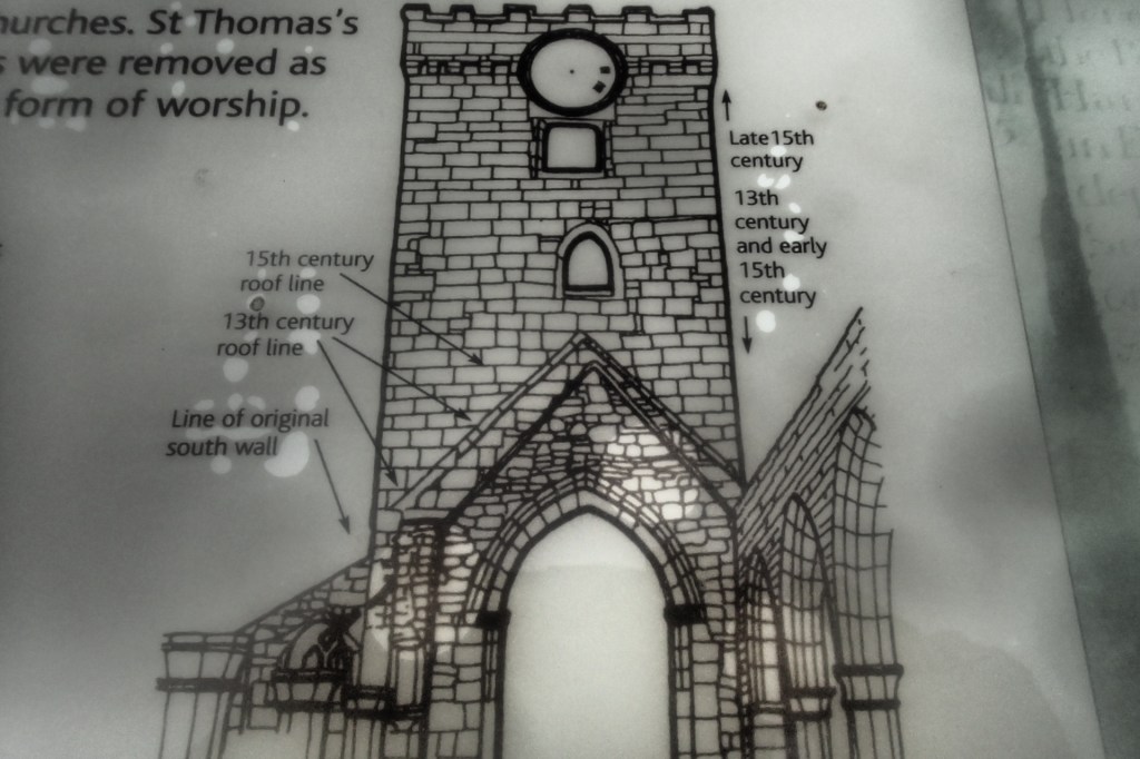
A rare gem of ecclesiastical architecture remains here. It is only one of three examples in the country of two medieval churches being built next to each other, due mostly to one having fallen into disrepair a long time ago. The notice boards provide handy historical oversight and a good visual check on how old various parts of the structure are.

From the churchyard, head back to the main cobbled street that runs through Heptonstall and take a right turn just before the pub on the corner. Go along this short lane, passing a public footpath sign until you come to a path to the right (unsigned). There is a table and chairs there which sort make you think it is someone’s garden (it probably is) but this is also officially the Calderdale Way. Head down the track.
Cross the road, continue down the track and over another road, until you are next to the river. Follow the path as it curves to the left, and you will arrive at a small pub called The Blue Pig. Walk through the beer garden, head right over the bridge and arrive at the busy road leading to the National Trust centre for Hardcastle Crags.
Up slightly to your right there are some public toilets if you need them, otherwise find the path immediately to the right of the toilets and head up the stony track, heading left by the house on the corner. This will take you up to Pecket Well Clough, which is quite a nice spot to have some food.
After this, head left, steeply uphill, arriving at Pecket Well. Go left a little way until you see the Weslyan Cemetery and take up the track just in front of it. This will lead you up to a bend in the path, bear right, going away from the farmhouse, and continue straight up. There are a number of ways on to the moor edge from here, and you should head for the Calderdale Way track marked on your OS map.
Follow this trail right around the moor edge, until you reach a large standing stone, known locally as Churn Milk Joan. From here, at the crossroads, head downhill and when you see a number of stone-walled fields in front of you, the track will head to the right, downhill. Follow this path to Midgley Road, turn right, downhill steeply, until you are back in Mytholmroyd.
Video of the walk here:

Leave a comment